An overview of Chestfield's origins
The longest lasting environmental problem that formed Chestfield
Chestfield was in the middle of a route taken by the first inhabitants of Britain, who came to the island after the Ice Age began to withdraw. The land bridge across the Channel and the flint deposits along its northern edge produced evidence of sustained occupation throughout pre-history. These are described in the Archeology of Kent to AD 800 published by Kent County Council.
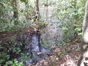
The land occupied by the current Chestfield was used, possibly continually, in the Stone Age, the Bronze Age and the Iron Age. Archaeological excavations carried out in Primrose Way and Churchwood Drive provide evidence of sustained use by the peoples of these times, with extensive drainage to cope with the vulnerability of the land to being waterlogged - a problem that is still with us.
While there has been no evidence of Roman settlement, the people who lived where Chestfield now stands were on the front line in dealing with Anglo-Saxon incomers at the end of Roman Britain in the 5th century (Reculver was the only major defensive fort that was fully garrisoned during the last century of Britain's life as Roman Province). It benefited from being part of Church lands once Christianity came to Kent in the 6th century, but returned to being at the centre of conflict as the Danes began to raid the English coast. Sheppy was a major Danish stronghold so the Kentish Saxons of the north coast must have lived under continual threat.
Chestfield was one of the earliest areas given over to the Church as the Monastery that was based at Reculver (possibly exploiting the Roman fortifications), which spread its control over the land west to Swaleciffe and south to the woodland slopes that now form the southern part of the Parish.
The Church lands passed to St Augustine's Abby and were taken over by William the Conqueror's half Brother Bishop Odo after 1066. At this point it was probably steadily growing into a thriving example of a local administrative centre, increasing in importance until it had three Tythe Barns that housed the grain and other tythe revenues from farms around the area of modern Chestfield. The name 'Chestfield' was first used in the 14th century, an anglicised version of Chestvyl, which was used at least 100 years earlier. As we shall see, there is evidence to show it was an early example of the replacement of feudal control by a family that became wealthy enough to buy their way into being major landowners. It was the converging point of the droves from the north coast, that is the driving routes for cattle, pigs and other livestock down to Canterbury, and possibly a major tree felling and fuel centre through what was called 'radfalling' work, done alongside the droves as they passed through the woodlands between Chestfield and Canterbury.
Edward Hasted [1732-1812], The History and Topographical Survey of the County of Kent (published in 8 volumes) shows that by the late 15th century it was treated as an appropriate living place for the Roper family, one of whom was a both a national figure and used as the basis for a character in Tom Stoppard's play A Man for All Seasons, because he became Attorney General to Henry VIII and had a key role in the life and death of Sir Thomas Moore.
We will see how during the remaining period that towns were still a small part of the population, that is up until the Victorian era, rural hubs like Chestfield were more important than we now realize. It is possible Chestfield became less significant as Whitstable expanded through the 19th century. In the early 20th century, through the coming together of commercial and social pressures, Chestfield became re-invented as a unified village. It was re-constructed using ideas that now look quaint - a miniature Garden City, a centre that would have its own aerodrome, attracting prosperous people with mock Tudor homes as well as offering 'golfing cottages' for those who would treat Chestfield as the Costa del Sol of its time.
Your comments on this are welcome - click here
